University of Minnesota
http://www.umn.edu/
612-625-5000
http://www.umn.edu/
612-625-5000
Minnesota Biodiversity Atlas
Bell Museum
Dataset: MIN-Bryophytes
Search Criteria: Canary Islands; excluding cultivated/captive occurrences
1
Page 1, records 1-9 of 9
Bell Museum bryophytes | |
 MIN:Bryophytes | 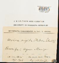 Aloina rigida (Hedw.) Limpr. 633104[1097297]N. Bryhn s.n.1908-05-10 Canary Islands, Tenerife, Lat. Sept. 28" 30'; Agua Manza, 1200m |
MIN:Bryophytes | 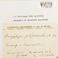 Campylopus introflexus (Hedw.) Brid. 640493[1115010] s.n.1908-05-05 Canary Islands, Tenerife, 28 30, 300m |
MIN:Bryophytes | 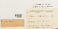 Ditrichum subulatum Hampe 642526[1125148] s.n.1908-05-03 Canary Islands, Tenerife, 28"30' lat, 700m |
MIN:Bryophytes | 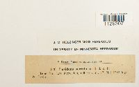 Fissidens serrulatus Brid. 639618[1129307]Bryhn, Niels 8201908-05-17 Canary Islands, Province of Santa Cruz de Tenerife, Tenerift, 600m |
MIN:Bryophytes | 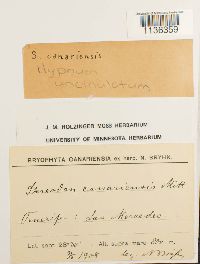 Hypnum uncinulatum Jur. 649466[1136359]Bryhn, N. s.n.1908-05-03 Canary Islands, Tenerife, 800m |
MIN:Bryophytes | 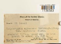 Isopterygium albescens var. applanatum M. Fleisch. 399072[1136583]Moore, John W. 801927-04-22 Canary Islands, Society Islands, Society Islands, Raiatea Island, Averaiti Valley, upper end, 300m |
MIN:Bryophytes |  Isothecium myosuroides Brid. 646354[1136834]Bryhn, N. s.n.1908-05-03 Canary Islands, Tenerife, Las Mercedes, 750m |
MIN:Bryophytes |  Leucobryum glaucum (Hedw.) Ångström 646735[1140054]Pitard, C.J. s.n.1906-02-00 Canary Islands, Tenerife, 800m |
MIN:Bryophytes | 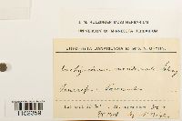 Plasteurhynchium meridionale (Schimp.) M. Fleisch. 643291[1152359]Bryhn, N. s.n.1908-05-07 Canary Islands, Tenerife, 300m |
1
Page 1, records 1-9 of 9
Google Map
Google Maps is a web mapping service provided by Google that features a map that users can pan (by dragging the mouse) and zoom (by using the mouse wheel). Collection points are displayed as colored markers that when clicked on, displays the full information for that collection. When multiple species are queried (separated by semi-colons), different colored markers denote each individual species.